
Plane table survey
What is a plane survey?
Plane surveys are the most commonly practised method of surveying and treat the earth as a flat or "plane" surface. Good enough for small-scale surveys
in limited areas, the curvature of the earth has no effect on the
results, thus the computations and results can be referenced to a plane or flat surface.
What is the purpose of Compass surveying?
Compass surveying is a type of surveying in which the directions of surveying lines are determined with a magnetic compass, and the length of the surveying lines are measured with a tape or chain or laser range finder. The compass is generally used to run a traverse line.
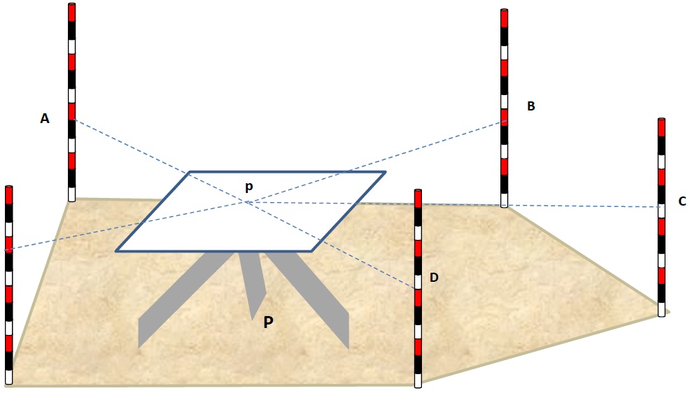
Use of a plane table
In use, a plane table is set over a point and brought to precise horizontal level. A drawing sheet is attached to the surface and an alidade is used to sight objects of interest. The alidade, in modern examples of the instrument a rule with a telescopic sight, can then be used to construct a line on the drawing that is in the direction of the object of interest.By using the alidade as a surveying level, information on the topography of the site can be directly recorded on the drawing as elevations. Distances to the objects can be measured directly or by the use of stadia marks in the telescope of the alidAdvantages of Plane Table Survey
-
It is suitable for location of details as well as contouring for large scale maps directly in the field.
-
As surveying and plotting are done simultaneously in the field, chances of getting omission of any detail get less.
-
The plotting details can immediately get compared with the actual objects present in the field. Thus errors as well as accuracy of the plot can be ascertained as the work progresses in the field.
-
Contours and specific features can be represented and checked conveniently as the whole area is in view at the time of plotting.
-
Only relevant details are located because the map is drawn as the survey progresses. Irrelevant details get omitted in the field itself.
-
The plane table survey is generally more rapid and less costly than most other types of survey.
-
As the instruments used are simple, not much skill for operation of instruments is required. This method of survey requires no field book.


0 टिप्पणी(ण्या):
टिप्पणी पोस्ट करा